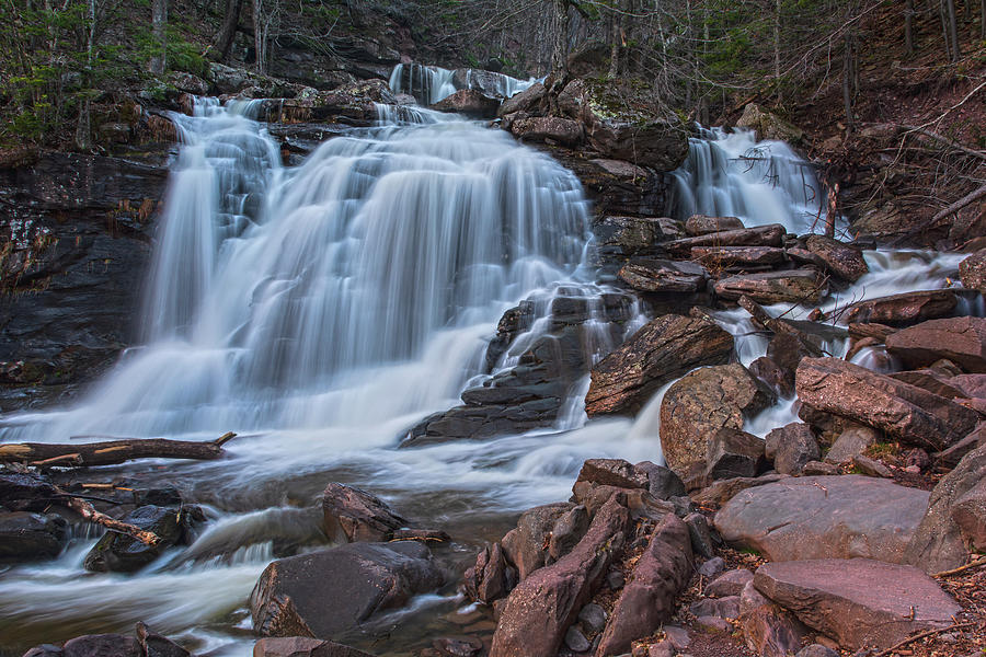
The sun will shine up the Lake Creek Ravine later in the day. The best photo opportunity is usually later in the day. High water usually comes after 4-5 inches of rain. But, at high water you will see the same view as the pictures displayed below. Usually, Lake Creek is at low water, and the view is disappointing. On a weekend, thousands of people line the road to hike up to the base of Kaaterskill Falls. This is the most popular trail in the Catskill Mountains. After going around the Horseshoe turn (by Bastion Falls), park 1/4 mile past the Falls at Rip's Lookout.īastion Falls is at the Trail head to the trail to Kaaterskill Falls.Go approximately 6.6 miles to Cairo, NY.Take a left out of the NYS Thruway entrance road.Take New York State Thruway to Exit 21 (Catskill).Known Access Safety: Walking down the road is very dangerous - Walk on the other side of the guard rail on the west bound laneĪttractions: Great view from the bridge on Rt 23aĬommon Animals: Too populated to see wildlife on a regular basisĪccess Methods: Bastion Falls are right on Rt 23a.ĭirections to Trail Head to the Bottom of Kaaterskill Falls from the NYS Thruway Known Access Safety: Do NOT hike hear the falls or the trail when creek is raging Known Access Safety: The rocks near the water can be dangerous Known Access Safety: These waterfalls can be very dangerous after a rain storm. Map No: VO: Road walk - TC: Map #141 - NG: #16 - USGS: Kaaterskill Quadĭigital Mapper: Topo Terrain Satellite DEC-Trail-Map (pdf) DEC-GIS-Map Greene-County-Property-GIS-Map Trail Information: Hiking Kaaterskill FallsĮlevation Loss: 55' from Molly Smith (Rip's Lookout) Parking Lot.Īccess to top of waterfalls: Hike from Rt 23aĪccess to bottom of waterfalls: Next to the bridge on Rt 23a (horseshoe turn) The sun will shine up the clove late in the afternoon.

Hiking Distance: ~0.5 miles (round trip).īest time to Visit: After a large rain storm (4-5" of rain) and in the late afternoon. When there is 10"+, the falls look scary, and they are dangerous. After a rain storm of 4-5" the falls looks the best. In the middle of the summer the flow of water is very poor. When hiked from the bottom of Lake Creek, it is very difficult to get above the falls. Previous or Alternate Names: Sebation Falls, Horse shoe Falls, Rip Van Winkle Fallsĭescription: This waterfall consist of 3 drops. Total Height: 71' (measured by Dean Goss at Waterfalls of the NE )ĭeg, Min, Sec location: N42 11 29, W74 04 13

Be sure to spend some time enjoying this smaller fall.Order within ravine: 2nd of 2 drops (1=highest elevation) Although smaller and not as dramatic as Kaaterskill Falls, Bastion Falls, 71 feet high, is quite striking and beautiful. Hiking through the Catskills, on the way to Kaaterskill Falls, is Waterfalls of the Northeastern United States This is a narrow road with a fair amount of traffic, so be mindful of vehicular traffic as you walk from the parking area downhill to the horseshoe bend and trailhead."īeisel Rating: 3.32 (Class 4)Height = 71 feetįor source of information, directions, and more about The falls are clearly visible just upstream from the Route 23A bridge on the horseshoe bend in Kaaterskill Clove. "Bastion Falls is a roadside set of drops that lie about half a mile downstream of Kaaterskill Falls. Bastion Falls is located in Hunter, NY 12442 in Greene County.


 0 kommentar(er)
